Below are a number of free data sources from a variety of government bodies, organisations, businesses and individuals that you may find useful. The links are arranged geographically:
• Global data
• Data for the Americas
• Data for the Asia-Pacific region
• Data for Europe
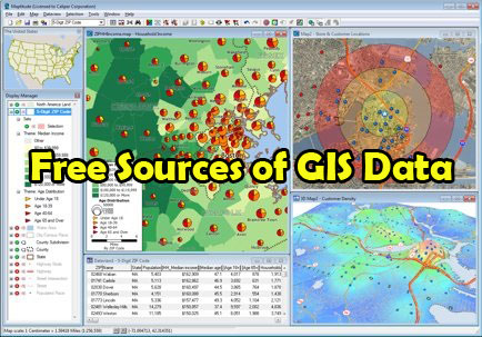
Free Sources of GIS data
Whilst every care has been taken in the preparation of this list, We take no responsibility for the correctness of this list, nor of the accuracy of the data at each source. We recommend that you consider the reputation of the provider and examine the data to satisfy your own requirements before use.
Free Global GIS Data
Armed conflict location and event data in the developing world (1997-present)
URL: http://www.acleddata.com/index.php/data
Note: Data for 1997-present; “developing world” countries only.
Atlas of the biosphere data from the Center for Sustainability and the Global Environment, University of Wisconsin-Madison
URL: http://www.sage.wisc.edu/atlas/maps.php
Note: Environmental variables.
Climate data from the Climatic Research Unit at the University of East Anglia
URL: http://www.cru.uea.ac.uk/cru/data/
Coastal water quality data from the Socioeconomic Data and Applications Center, Columbia University (1998, 2007)
URL: http://sedac.ciesin.columbia.edu/es/seawifs.html
Note: Data for 1998 and 2007.
Data on the extent and intensity of use of agricultural lands from the Socioeconomic Data and Applications Center, Columbia University (2000)
URL: http://sedac.ciesin.columbia.edu/es/aglands.html
Note: Data for 2000.
Global administrative areas data
URL: http://gadm.org/
Global aerosol data from GlobAerosol
URL: http://www.globaerosol.info/project_description/data.htm
Global anthropogenic biomes data from the Socioeconomic Data and Applications Center, Columbia University
URL: http://sedac.ciesin.columbia.edu/es/anthropogenicbiomes.html
Global burnt area data (2000) from the European Joint Research Centre Global Environment Monitoring Unit
URL: http://bioval.jrc.ec.europa.eu/products/burnt_areas_gba2000/global2000.php
Note: Data for 2000.
Global digital elevation data from the Consortium for Geospatial Information
URL: http://srtm.csi.cgiar.org
Global earthquake data from the United States Geological Survey
URL: http://earthquake.usgs.gov/earthquakes/eqarchives/epic/kml
Global hurricane and tropical cyclone track data from the National Geophysical Data Center at the National Oceanic and Atmosphere Administration, United States
URL: http://www.ncdc.noaa.gov/oa/ibtracs
Global irrigated and rainfed crop area data from the International Water Management Institute (IWMI)
URL: http://www.iwmigiam.org/info/main/index.asp
Global lakes and wetlands data from the World Wildlife Fund (WWF)
URL: http://www.worldwildlife.org/science/data/item1877.html
Global land cover data (2000) with specialist vegetation classifications from the European Joint Research Centre Global Environment Monitoring Unit
URL: http://bioval.jrc.ec.europa.eu/products/glc2000/data_access.php
Note: Data for 2000.
Global land cover data (2005-2006) from POSTEL
URL: http://postel.mediasfrance.org/en/PROJECTS/Preoperational-GMES/GLOBCOVER
Note: Data for 2005-2006.
Global mineral resource data from the United States Geological Survey
URL: http://tin.er.usgs.gov/mrds
Global natural hazard data from the Lamont-Doherty Earth Observatory, Columbia University
URL: http://www.ldeo.columbia.edu/chrr/research/hotspots/coredata.html
Global net primary productivity data from the Socioeconomic Data and Applications Center, Columbia University
URL: http://sedac.ciesin.columbia.edu/es/hanpp.html
Global potential evapo-transpiration & aridity index data from the Consortium for Geospatial Information
URL: http://csi.cgiar.org/Aridity
Global relief data, integrating land topography and ocean bathymetry from the National Geophysical Data Center at the National Oceanic and Atmosphere Administration, United States
URL: http://www.ngdc.noaa.gov/mgg/global/global.html
Global soil data from ISRIC – World Soil Information
URL: http://www.isric.nl/uk/about+soils/soil+data/thematic+data/soil+geographic+data
Global soil moisture data from the Institute of Photogammetry & Remote Sensing, Vienna University of Technology
URL: http://www.ipf.tuwien.ac.at/radar/index.php?go=ascat
Global terrorism data (1970-2008) from the National Consortium for the Study of Terrorism and Responses to Terrorism, University of Maryland
URL: http://www.start.umd.edu/gtd
Note: Data for 1970-2008.
Global tsunami data from the National Geophydsical Data Center at the National Oceanic and Atmosphere Administration, United States
URL: http://www.ngdc.noaa.gov/hazard/tsu_db.shtml
Global vegetation cover data at the last glacial maximum from the Department of Anthropology, University of Geneva
URL: http://anthro.unige.ch/lgmvegetation
Note: As at the last glacial maximum: 25,000 – 15,000 BP.
Harmonised world soil data from the International Institute for Applied Systems Analysis (IIASA)
URL: http://www.iiasa.ac.at/Research/LUC/External-World-soil-database/HTML/index.html?sb=1
Human influence & footprint data from the Socioeconomic Data and Applications Center, Columbia University
URL: http://sedac.ciesin.columbia.edu/wildareas
Hydrological data and maps based on STRM elevation data from the United States Geological Survey
URL: http://hydrosheds.cr.usgs.gov
Large urban area data (1950-2020) from Nordpil
URL: http://nordpil.com/go/resources/world-database-of-large-cities
Note: Data for 1950-2050.
Maritime boundary and areas of Exclusive Economic Zones data from Flanders Marine Institute
URL: http://www.vliz.be/vmdcdata/marbound/index.php
MODIS (Moderate Resolution Imaging Spectroradiometer) global land cover data from NASA
URL: http://earthobservatory.nasa.gov/Newsroom/view.php?id=22585
Natural Earth data from the North American Cartographic Information Society
URL: http://www.naturalearthdata.com
Note: Includes countries, disputed areas, populated places, urban polygons, parks and protected areas, water boundaries.
Past, present & predicted future global climate condition data from WorldClim
URL: http://www.worldclim.org
Protected areas data
URL: http://free-gis-data.blogspot.com/2009/04/world-spatial-database-on-protected.html
The World Bank Data Catalog
URL: http://data.worldbank.org/data-catalog
Free Sources of GIS Data
United Nations Environment Programme’s GEO Data Portal
URL: http://geodata.grid.unep.ch
Note: National, sub-regional, regional and global statistics on topics like freshwater, population, forests, emissions, climate, disasters, health and GDP.
Free Sources of GIS Data
United States National Geospatial Intelligence agency geographic names for geopolitical areas data
URL: http://earth-info.nga.mil/gns/html/namefiles.htm
Free Sources of GIS Data
Volcanogenic massive sulfide deposit data from the United States Geological Survey
URL: http://tin.er.usgs.gov/vms
Free Sources of GIS Data
World country borders data
URL: http://thematicmapping.org/downloads/world_borders.php
Free Sources of GIS Data
World population grid data from the Socioeconomic Data and Applications Center, Columbia University
URL: http://sedac.ciesin.columbia.edu/gpw
Free Sources of GIS Data
GIS Data for The Americas
Gis Data for Asia and Europe
Free Sources of GIS Data,Free Sources of GIS Data, Free Sources of GIS Data, Free Sources of GIS Data, Free Sources of GIS Data, Free Sources of GIS Data, Free Sources of GIS Data, Free Sources of GIS Data, Free Sources of GIS Data, Free Sources of GIS Data, Free Sources of GIS Data, Free Sources of GIS Data, Free Sources of GIS Data, Free Sources of GIS Data, Free Sources of GIS Data
Excellent post. I was checking continuously this blog and I am impressed!
Extremely useful information specially the last part 🙂 I care for such information a lot.
I was looking for this particular info for a long time.
Thank you and best of luck.
Welcome