Elementary Surveying in Civil Engineering
INTRODUCTION TO SURVEY
SURVEYING
Surveying is the art of determining the relative position of natural and man-made features on the surface of earth by making measurements in the horizontal plane.Measurements (Horizontal Distances and Angles) are made in the Horizontal plane only.
LEVELLING
Levelling is the art of determining the relative position of natural and man-made features on the surface of earth by making measurements in the vertical plane
Process of SURVEY
The process may be divided into three stages
(i) Taking a general view
It involves the need to obtain an overall picture of what is required before any type of survey work is undertaken. In land surveying, this is achieved during the reconnaissance study.
(ii) Observation and Measurement
The next stage of any survey constitutes to the measurement to determine the relative position and sizes of natural and artificial features on the land.
(iii) Presentation of Data:
The data collected in any survey must be presented in a form which allows the information to be clearly interpreted and understood by others. This presentation may take the form of written report, bills of quantities, datasheets, drawings and in land surveying maps and plan showing the features on the land.
OBJECTIVE OF SURVEYING
Survey is to collect data from the field depending upon the requirements. For engineers and architect/planners the requirement can be drawing of a map or plan.The objective of surveying is to show relative position of various objects on paper. Such representations on paper are called maps or plans
MAP/ PLAN
A plan or a map may be defined as the graphical representation of the features on the surface of the earth as projected on a horizontal plane to a suitable scale
DIFFERENCE BETWEEN A MAP AND A PLAN
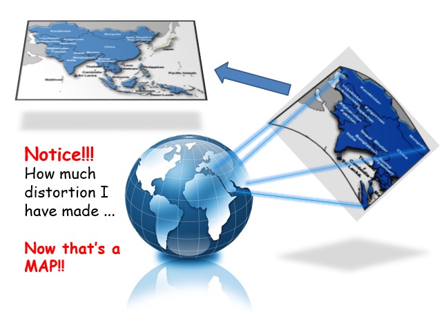
- Since the earth surface is curved and that of a paper is plane, no part of Earth can be represented on a paper without distortion
- If area to be represented is small, the distortion is less and a large scale can be used for drawing. Such representations are called plans.
- If area to be represented is large, the distortion is large and small scales are to be used for the drawing. Such representations are called maps.
APPLICATION OF SURVEY
- Topographical maps
- Road maps
- Cadastral maps
- Military surveys help in strategic planning
- Marine surveys help in planning navigation routes and harbors
- Archaeological maps
- Contour maps
- Mine surveys are required for exploring mineral wealth
- Geological surveys help in identifying underground resources
- Astronomical surveys help in study of astronomical movements of planets and for calculating local and standard times
TOPOGRAPHICAL MAP
-Maps showing Natural and Man-made features of an area.
-Natural features are trees, ponds, river, forests…
-Man-made features may include roads, canals, towns, villages….
MILITARY MAP
Maps showing communication means and areas of High Strategic importance for the defense of the country
(Military map of US in WWII)
ROAD MAP
Maps Showing Roads and Highways in an area
(Road Map of Pakistan)
GEOLOGICAL MAP
Maps showing regions with minerals and other geological resources of an area.
(Geological Map of Pakistan)
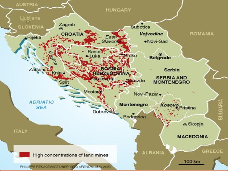
LAND MINE MAP
Part of Military Map showing land mines.
(Land mines in the Balkans- The major mountain range of Bulgaria and the Balkan Peninsula )
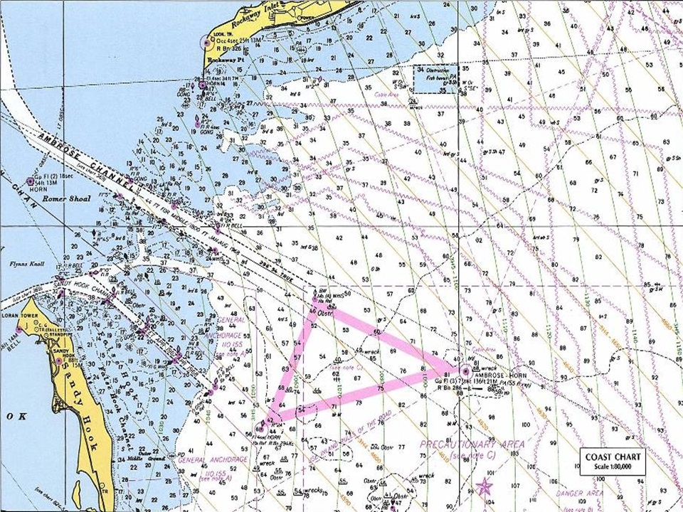
MARINE MAPS/NAVIGATIONAL CHARTS
Maps showing oceans and navigational charts
Hydro survey is undertaken to gather information in the marine environment such as mapping out the coast lines and sea bed in order to produce navigational charts
(New York Harbor Nautical Chart)
CADASTRAL MAP
Maps showing boundaries of a property.
For example boundaries of Fields, Houses, Buildings….
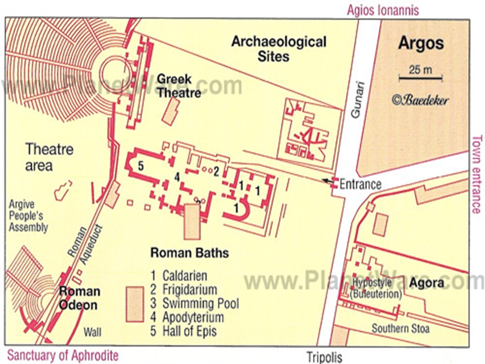
ARCHAEOLOGICAL MAP
Maps showing location of remains of ancient times
(Argos Archaeological sites map)
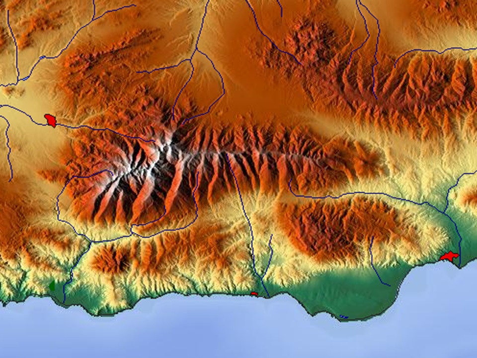
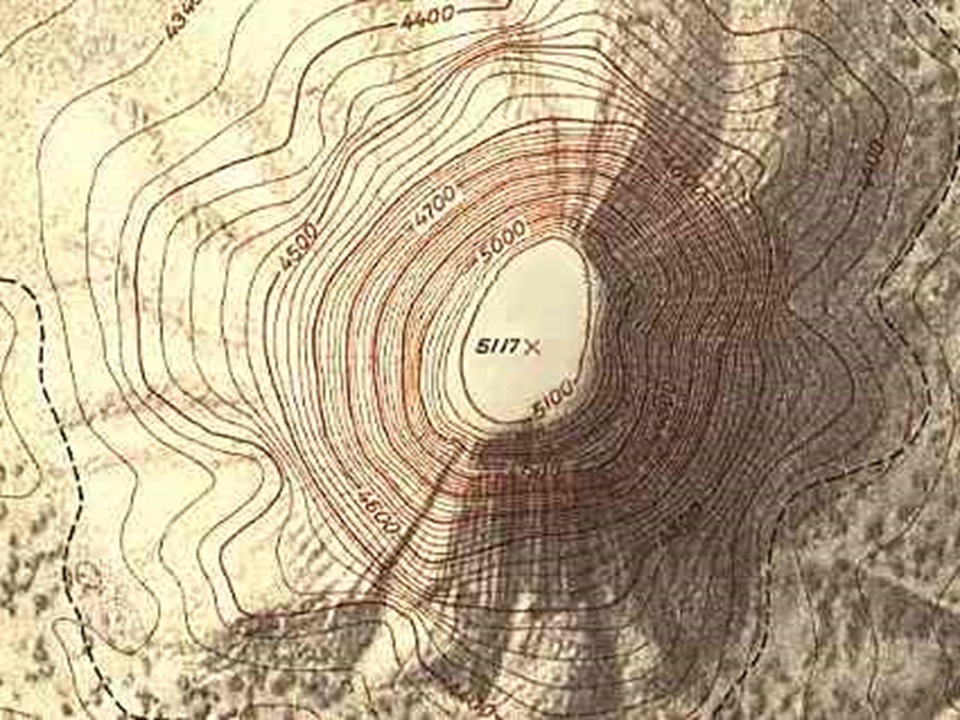
CONTOUR MAPS
Maps showing elevated and depressed areas in a region.
Maps show different levels on the surface of the earth.
Contour map are useful in determining
-the reservoir capacity of dams
-route for a road or railway track
-to decide the water supply and sewage flow direction in a scheme
RECONNAISSANCE
This is a preliminary survey of the land to be surveyed.
-It may be either ground reconnaissance or aerial reconnaissance survey.
-Reconnaissance is made on arrival to a new site during which an overall picture or view of the area is obtained.
-The most suitable position of stations is selected, the purpose of the survey and the accuracy required will be decided, and finally the method of observation will be established.
Objectives of Reconnaissance
-To ascertain the possibility of building or constructing route or track through the area.
-To choose the best one route and record on a map
-To estimate probable cost of a project and draft a report.
Classification of Surveying: Primary and Secondary
Elementary Surveying, Elementary Surveying, Elementary Surveying, Elementary Surveying, Elementary Surveying, Elementary Surveying, Elementary Surveying
